


Dewey Precinct, Stanton County, Nebraska
About
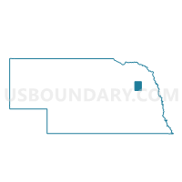
Outline

Summary
| Unique Area Identifier | 613971 |
| Name | Dewey Precinct |
| County | Stanton County |
| State | Nebraska |
| Area (square miles) | 35.50 |
| Land Area (square miles) | 35.45 |
| Water Area (square miles) | 0.05 |
| % of Land Area | 99.85 |
| % of Water Area | 0.15 |
| Latitude of the Internal Point | 42.04450380 |
| Longtitude of the Internal Point | -97.18050500 |
Maps


Graphs
Select a template below for downloading or customizing gragh for Dewey Precinct, Stanton County, Nebraska


Neighbors
Neighoring Voting District (by Name) Neighboring Voting District on the Map
- Chapin/Hancock/Winside Precinct, Wayne County, NE
- Elkhorn Precinct, Stanton County, NE
- Hoskins/Garfield Precinct, Wayne County, NE
- Pilger Precinct, Stanton County, NE
- Spring Branch Precinct, Stanton County, NE
- Spring Branch Precinct 2, Stanton County, NE
- Stanton A Precinct, Stanton County, NE
- Stanton B Precinct, Stanton County, NE
Top 10 Neighboring County Subdivision (by Population) Neighboring County Subdivision on the Map
- Spring Branch precinct, Stanton County, NE (2,457)
- Hoskins precinct, Wayne County, NE (699)
- Pilger precinct, Stanton County, NE (559)
- Hancock precinct, Wayne County, NE (397)
- Elkhorn precinct, Stanton County, NE (224)
- Stanton precinct, Stanton County, NE (208)
- Dewey precinct, Stanton County, NE (194)
Top 10 Neighboring Unified School District (by Population) Neighboring Unified School District on the Map
- Norfolk Public Schools, NE (29,772)
- Wisner-Pilger Public Schools, NE (2,559)
- Stanton Community Schools, NE (2,455)
- Winside Public Schools, NE (1,072)
Top 10 Neighboring State Legislative District Upper Chamber (by Population) Neighboring State Legislative District Upper Chamber on the Map
Top 10 Neighboring 111th Congressional District (by Population) Neighboring 111th Congressional District on the Map
Top 10 Neighboring Census Tract (by Population) Neighboring Census Tract on the Map
- Census Tract 9622, Stanton County, NE (4,536)
- Census Tract 9786, Wayne County, NE (3,683)
- Census Tract 9621, Stanton County, NE (1,593)